About Me

My name is Yingjie (Jason) Hu. I am an Associate Professor in the Department of Geography at the University at Buffalo (UB), The State University of New York (SUNY). I am also
an Adjunct Professor in the Department of Computer Science and Engineering, and an Affiliate Faculty of the Center for Geological and Climate Hazards and the AI and Data Science Institute at UB.
My research expertise is in geospatial AI (GeoAI), natural hazards, geographic information science, and disaster management. I lead the GeoAI Lab@UB,
a research group focusing on integrating geospatial data, GIS, and AI methods to understand human-environment interactions under disaster contexts and to address disaster-related challenges.
The disasters we have studied include wildfires, winter storms, and hurricanes. Because disasters are highly complex, our research is interdisciplinary by nature and we frequently interact and collaborate with researchers from Civil and Environmental Engineering, Earth System Science, Environmental Science, and Computer Science and Engineering.
The research of my group contributes to better understandings of disaster-related human-environment interactions and helps build a more resilient and sustainable society.
Prospective Students: If you are interested in working with me, please check this Opportunities page to see whether there is an opening.
Research Expertise
Research Areas:
- Natural Hazards
- Human-Environment Interactions
- Disaster Management
- Community Resilience
Research Methods:
- Geospatial AI (GeoAI)
- GIS
- Remote Sensing
- Spatial Analysis
Honors and Awards
- Community Champion, by University Consortium for Geographic Information Science (UCGIS) and NSF I-GUIDE Institute, 2025
- World's Top 2% Scientists, by Stanford University and Elsevier, 2025
- Early/Mid-Career Research Award, by University Consortium for Geographic Information Science, 2024
- Emerging Scholar Award, by American Association of Geographers (AAG) Spatial Analysis & Modeling (SAM) Specialty Group, 2024
- Young Scholar Award, by International Association of Chinese Professionals in Geographic Information Sciences (CPGIS), 2023
- Exceptional Scholar: Young Investigator Award, by University at Buffalo, 2022
- Finalist of the Best Full Paper Award, by GIScience Conference Organization Committee, 2021
- Global Young Scientist Award, by World Geospatial Developers Conference (WGDC), 2021
- Waldo-Tobler GIScience Young Researcher Award, by Austrian Academy of Sciences, 2020
- Best GIScience Full Paper Award, by GIScience Conference Organization Committee, 2018
- Professional and Scholarly Development Award, by University of Tennessee Knoxville, 2017
- CaGIS Doctoral Scholarship, by Cartography and Geographic Information Society (CaGIS), 2016
- Excellence in Research Award, by UCSB Geography, 2016
- CESASC Scholarship Award, by Chinese-American Engineers and Scientists Association of Southern California (CESASC), 2016
- National Award for Outstanding Chinese Students Studying Abroad, by China Scholarship Council, 2015
- Graduate Dissertation Fellowship, by University of California Santa Babara (UCSB) Graduate Division, 2015
- Early Career Scholar Travel Grant, by NSF EarthCube Program, 2015
- Graduate Travel Grant, by UCSB Graduate Division, 2015
- International Geographic Information Fund Award, by American Association of Geographers, 2015
- Graduate Travel Grant, by UCSB Graduate Student Association, 2015
- Graduate Dissertation Fellowship, by UCSB Affiliates, 2014
- 2nd Prize for Learning Analytics and Knowledge (LAK) Data Challenge, by LAK Challenge Organization Committee, 2014
- Jack Dangermond Graduate Fellowship, by UCSB Geography, 2013
- Finalist Prize for AAG Robert Raskin Mashup Mapping Competition, by AAG Cyberinfrastructure (CI) Specialty Group, 2013
- Jack Dangermond Travel Award, by UCSB Geography, 2012, 2013, 2014, 2015
- NSF Travel Award for the 20th ACM SIGSPATIAL conference, by the SIGSPATIAL Conference Organization Committee, 2012
- NSF Travel Award for the 6th RR Conference, by RR Conference Organization Committee, 2012
- Doctoral Scholars Fellowship, by UCSB Geography, 2011
- Excellent Master Thesis, by East China Normal University (ECNU) Geography, 2011
- Graduate Fellowship, by ECNU Geography, 2010, 2011
- Excellent Graduate, by Shanghai Municipal Education Commission, 2008
- Excellent Bachelor Thesis, by ECNU Geography, 2008
- Undergraduate Fellowship, by ECNU Geography, 2005, 2007
Education
| • 9/2011 - 6/2016: | Ph.D. in Geography Department of Geography University of California, Santa Babara, USA |
| • 9/2008 - 6/2011: | M.S. in Cartography and GIS School of Natural Resources and Environmental Sciences East China Normal University, Shanghai, China |
| • 9/2004 - 6/2008: | B.S. in Cartography and GIS School of Natural Resources and Environmental Sciences East China Normal University, Shanghai, China |
Publications
( *: Corresponding/senior author; _: students and postdocs)Refereed Journal Articles
- Kim, J., Hu, Y.*, Elhami-Khorasani, N., Sun, K., & Zhou, R.Z. (2026): Assessment of deep learning models integrated with weather and environmental variables for wildfire spread prediction and a case study of the 2023 Maui fires. Natural Hazards, 122, Article 10.
- Sun, K., Hu, Y.*, & Joseph, K. (2026): A dataset from ten disasters for studying location descriptions and training AI models. Nature Scientific Data, in press.
- Butler, M., Khan, A., Afrifa, F.O.T., Hu, Y., and Taylor, D., (2026): Multilayer networks characterize human-mobility patterns by industry sector for the 2021 Texas winter storm. npj Complexity, 3(1), Article 15.
- Zhou, R.Z., Hu, Y.*, Sun, K., Muldoon, R., Clark, S., & Joseph, K., (2025): Explainable GeoAI and statistical analysis reveal complementary insights about disparities of 311 help requests during the 2022 Buffalo blizzard. International Journal of Disaster Risk Reduction, 105635.
- Sun, K., Hu, Y.*, Joseph, K., & Zhou, R.Z. (2025): GALLOC: A GeoAnnotator for Labeling LOCation descriptions from disaster-related text messages. International Journal of Geographical Information Science, 39(8), 1623-1653.
- Reades, J., Hu, Y., Tranos, E., & Delmelle, E., (2025): The city as text. Nature Cities, 1-7.
- Li, W., Arundel, S., Gao, S., Goodchild, M., Hu, Y., Wang, S., & Zipf, A. (2024): GeoAI for Science and the Science of GeoAI. Journal of Spatial Information Science, 29, 1-17.
- Sun, K., Zhou, R.Z., Kim, J., & Hu, Y.*, (2024): PyGRF: An improved Python Geographical Random Forest model and case studies in public health and natural disasters. Transactions in GIS, 28(7), 2476-2491.
- Zhou, R.Z., Hu, Y.*, Zou, L., Cai, H. & Zhou, B. (2024): Understanding the disparate impacts of the 2021 Texas winter storm and power outages through mobile phone location data and nighttime light images. International Journal of Disaster Risk Reduction, 104339.
- Hu, Y.*, Goodchild, M., Zhu, A.X., Yuan, M., Aydin, O., Bhaduri, B., Gao, S., Li, W., Lunga, D., & Newsam, S. (2024): A five-year milestone: reflections on advances and limitations in GeoAI research. Annals of GIS, 30(1), 1-14.
- Mai, G., Huang, W., Sun, J., Song, S., Mishra, D., Liu, N., Gao, S., Liu, T., Cong, G., Hu, Y., & Cundy, C., (2024): On the opportunities and challenges of foundation models for GeoAI. ACM Transactions on Spatial Algorithms and Systems, 10(2), Article 11.
- Tirabassi, J.N., Wang, J., Zhou, R.Z., & Hu, Y. (2024): Human mobility data demonstrates increase in park visitation since start of COVID-19 pandemic in Buffalo, New York. Preventive Medicine Reports, 102650.
- Magid, H.S.A., Desjardins, M.R., & Hu, Y. (2024): Opportunities and shortcomings of AI for spatial epidemiology and health disparities research on aging and the life course. Health & Place, 89, p.103323.
- Hu, Y.*, Mai, G., Cundy, C., Choi, K., Lao, N., Liu, W., Lakhanpal, G., Zhou, R.Z., & Joseph, K. (2023): Geo-knowledge-guided GPT models improve the extraction of location descriptions from disaster-related social media messages. International Journal of Geographical Information Science, 37(11), 2289-2318.
- Sun, K., Hu, Y.*, Ma, Y., Zhou, R.Z., & Zhu, Y. (2023): Conflating point of interest (POI) data: A systematic review of matching methods. Computers, Environment and Urban Systems, 103, 101977.
- Hu, X., Zhou, Z., Li, H., Hu, Y., Gu, F., Kersten, J., Fan, H. & Klan, F., (2023): Location reference recognition from texts: A survey and comparison. ACM Computing Surveys, 56(5), article 112, 1–37.
- Zhou, B., Zou, L., Hu, Y., Qiang, Y., & Goldberg, D. (2023): TopoBERT: a plug and play toponym recognition module harnessing fine-tuned BERT. International Journal of Digital Earth, 16(1), 3045-3063.
- Zhou, R.Z., Hu, Y.*, Tirabassi, J., Ma, Y., & Xu, Z. (2022): Deriving neighborhood-level diet and physical activity measurements from anonymized mobile phone location data for enhancing obesity estimation. International Journal of Health Geographics, 21(1), 1-18.
- Ma, Y., Hu, Y.*, Moncrieff, G.R., Slingsby, J.A., Wilson, A.M., Maitner, B., & Zhou, R.Z. (2022): Forecasting vegetation dynamics in an open ecosystem by integrating deep learning and environmental variables. International Journal of Applied Earth Observation and Geoinformation, 114, 103060.
- Mai, G., Hu, Y., Gao, S., Cai, L., Martins, B., Scholz, J., Gao, J., & Janowicz, J. (2022): Symbolic and subsymbolic GeoAI: Geospatial knowledge graphs and spatially explicit machine learning. Transactions in GIS, 26, 3118-3124.
- Lunga, D., Hu, Y., Newsam, S., Gao, S., Martins, B., Yang, L., & Deng, X. (2022): GeoAI at ACM SIGSPATIAL: The new frontier of geospatial artificial intelligence research. SIGSPATIAL Special, 13(1-3), 21-32.
- Psyllidis, A., Gao, S., Hu, Y., Kim, E.K., McKenzie, G., Purves, R., Yuan, M. & Andris, C. (2022): Points of Interest (POI): a commentary on the state of the art, challenges, and prospects for the future. Computational Urban Science, 2(1), 1-13.
- Chang, T., Hu, Y.*, Taylor, D., & Quigley, B.M. (2022): The role of alcohol outlet visits derived from mobile phone location data in enhancing domestic violence prediction at the neighborhood level. Health & Place, 73, 102736.
- Hu, Y.*, Gui, Z., Wang, J., & Li, M. (2022): Enriching the metadata of map images: a deep learning approach with GIS-based data augmentation. International Journal of Geographical Information Science, 36(4), 799–821.
- Mai, G., Janowicz, K., Hu, Y., Gao, S., Yan, B., Zhu, R., Cai, L., & Lao, N. (2022): A review of location encoding for GeoAI: methods and application. International Journal of Geographical Information Science, 36(4), 639–673.
- Hu, Y.*, Quigley, B.M. & Taylor, D., (2021): Human mobility data and machine learning reveal geographic differences in alcohol sales and alcohol outlet visits across US states during COVID-19. PlOS ONE, 16(12), p.e0255757.
- Wilson, J., Butler, K., Gao, S., Hu, Y., Li, W., & Wright, D. (2021): A five-star guide for achieving replicability and reproducibility when working with GIS software and algorithms. Annals of the American Association of Geographers, 111(5), 1311-1317.
- Sun, K., Hu, Y.*, Song, J., & Zhu, Y. (2021): Aligning geographic entities from historical maps for building knowledge graphs. International Journal of Geographical Information Science, 35(10), 2077-2106.
- Hu, Y.* & Wang, R.Q. (2020): Understanding the removal of precise geotagging in tweets. Nature Human Behaviour, 4, 1219–1221.
- Wang, J., Hu, Y.*, & Joseph, K. (2020): NeuroTPR: A Neuro-net ToPonym Recognition model for extracting locations from social media messages. Transactions in GIS, 24(3), 719-735.
- Wang, R.Q., Hu, Y., Zhou, Z. & Yang, K., (2020): Tracking flooding phase transitions and establishing a passive hotline with AI-enabled social media data. IEEE Access Journal, 8(1), 103395-103404.
- Andris, C., Ayers, E., Grossner, K., Hu, Y., Hart, K., Thatcher, J., Tally Jr, R.T. & Giordano, A. (2020): Towards geospatial humanities: reflections from two panels. International Journal of Humanities and Arts Computing, 14(1-2), 6-26.
- Janowicz, K., Gao, S., McKenzie, G., Hu, Y. & Bhaduri, B. (2020): GeoAI: Spatially explicit artificial intelligence techniques for geographic knowledge discovery and beyond, International Journal of Geographic Information Science, 34(4), 625-636.
- Wang, J. & Hu, Y.* (2019): Enhancing spatial and textual analysis with EUPEG: an extensible and unified platform for evaluating geoparsers. Transactions in GIS, 23(6), 1393-1419.
- Hu, Y.*, Gao, S., Lunga, D., Li, W., Newsam, S. & Bhaduri, B. (2019): GeoAI at ACM SIGSPATIAL: progress, challenges, and future directions. SIGSPATIAL Special, 11(2), 5-15.
- Hu, Y.*, Deng, C., & Zhou, Z. (2019): A semantic and sentiment analysis on online neighborhood reviews for understanding the perceptions of people toward their living environment. Annals of the American Association of Geographers, 109(4), 1052-1073.
- Hu, Y.* (2018): Geo-text data and data-driven geospatial semantics. Geography Compass, 12(11), e12404.
- Hu, Y.*, Mao, H., & McKenzie, G. (2018): A natural language processing and geospatial clustering framework for harvesting local place names from geotagged housing advertisements. International Journal of Geographical Information Science, 33(4), 714-738.
- McKenzie, G., Liu, Z., Hu, Y., & Lee, M. (2018): Identifying urban neighborhood names through user-contributed online property listings, ISPRS International Journal of Geo-Information, 7(10), 388-411.
- Mai, G., Janowicz, K., Hu, Y., & Gao, S. (2018): ADCN: an anisotropic density-based clustering algorithm for discovering spatial point patterns with noise, Transactions in GIS, 22(1), 348-369.
- Gao, S., Janowicz, K., Montello, D., Hu, Y., Yang, J.-A., McKenzie, G., Ju, Y., Gong, L. Adams, B., & Yan, B. (2017): A data-synthesis-driven method for detecting and extracting vague cognitive regions. International Journal of Geographical Information Science, 31(6), 1245-1271.
- Hu, Y.*, Ye, X., & Shaw, S.-L. (2017): Extracting and analyzing semantic relatedness between cities using news articles. International Journal of Geographical Information Science, 31(12), 2427-2451.
- Hu, Y.*, Janowicz, K., & Couclelis, H. (2017): Prioritizing disaster mapping tasks for online volunteers based on information value theory. Geographical Analysis, 49, 175–198.
- Zhu, R., Hu, Y., Janowicz, K., & McKenzie, G. (2016): Spatial signatures for geographic feature types: examining gazetteer ontologies using spatial statistics. Transactions in GIS, 20(3), 333-355.
- Hu, Y.*, Janowicz, K., & Chen, Y. (2016): Task-oriented information value measurement based on space-time prisms, International Journal of Geographical Information Science, 30(6), 1228-1249.
- Hu, Y.*, Gao, S., Janowicz, K., Yu, B., Li, W., & Prasad, S. (2015): Extracting and understanding urban areas of interest using geotagged photos, Computers, Environment and Urban Systems, 54, 240-254.
- Hu, Y.*, Janowicz, K., Prasad, S., & Gao S. (2015): Metadata topic harmonization and semantic search for Linked-Data-driven geoportals: a case study using ArcGIS Online, Transactions in GIS, 19(3), 398-416.
- Hu, Y.*, Lv, Z., Wu, J., Janowicz, K., Zhao, X., & Yu, B. (2015): A multistage collaborative 3D GIS to support public participation, International Journal of Digital Earth, 8(3), 212- 234.
- Chen, Z., Yu, B., Hu, Y., Huang, C., Shi, K., & Wu, J. (2015): Estimating house vacancy rate in metropolitan areas using NPP-VIIRS nighttime light composite data, IEEE Journal of Selected Topics in Applied Earth Observations and Remote Sensing, 8(5), 2188-2197.
- Shi, K., Yu, B., Hu, Y., Huang, C., Chen, Y., Huang, Y., Chen, Z., & Wu J. (2015): Modeling and mapping total freight traffic in China using NPP-VIIRS nighttime light composite data, GIScience & Remote Sensing, 52(3), 274-289.
- Yu, B., Shi, K., Hu, Y., Huang, C., Chen, Z., & Wu, J. (2015): Poverty evaluation using NPP-VIIRS nighttime light composite data at the county level in China, IEEE Journal of Selected Topics in Applied Earth Observations and Remote Sensing, 8(3), 1217-1229.
- McKenzie, G., Janowicz, K., Gao, S., Yang, J., & Hu, Y. (2014): POI Pulse: a multi-granular, semantic signature–based information observatory for the interactive visualization of big geosocial data, Cartographica: The International Journal for Geographic Information and Geovisualization, 50(2), 71-85.
- Shi, K., Yu, B., Huang, Y., Hu, Y., Yin, B., Chen, Z., Chen, L., & Wu, L. (2014): Evaluating the ability of NPP-VIIRS nighttime light data to estimate the gross domestic product and the electric power consumption of China at multiple scales: a comparison with DMSP-OLS data, Remote Sensing, 6 (2), 1705-1724.
- Chen, Z., Yu, B., Huang, Y., Hu, Y., Lin, H., & Wu, J. (2013): Validation of total ozone column derived from OMPS using ground-based spectroradiometer measurements, Remote Sensing Letters, 4 (10), 937-945.
- Lin, H., Yu, B., Chen, Z., Hu, Y., Huang, Y., Wu, J., Wu, B., & Ge, R. (2013): A geospatial web portal for sharing and analyzing greenhouse gas data derived from satellite remote sensing images, Frontiers of Earth Science, 7 (3), 295-309.
- Yu, B., Liu, H., Wu, J., Hu, Y., & Zhang, L. (2010): Automated derivation of urban building density information using airborne LiDAR data and object-based method, Landscape and Urban Planning, 98 (3-4), 210-219.
- Hu, Y.* & Wu, J. (2010): Design of enterprise three-dimensional GIS based on skyline and ExtJS, Science of Surveying and Mapping, 35 (6), 247-249. (in Chinese)
- Li, J., Wu, J., & Hu, Y. (2009): Development of three-dimensional urban scanning system using TerraExplorer Pro, Computer Technology and Development, 6, 66-68. (in Chinese)
Edited Books
- Janowicz, K., Zhu, R., Mai, G., Gao, S., Hu, Y., Wang, Z., Cai, L., & Bennett, B. (2026): Geography According to Foundation Models, IOS Press.
- Gao, S., Hu, Y., & Li, W. (2023): Handbook of Geospatial Artificial Intelligence, Taylor & Francis Group. [Book Preview]
Refereed Book Chapters
- Janowicz, K., Mai, G., Zhu, R., Gao, S., Wang, Z., Hu, Y., & Bennett, L., (2026): Geography according to ChatGPT-- How generative AI represents and reasons about geography. In Janowicz, K. et al. (Eds), Geography According to Foundation Models, IOS Press.
- Sun, K., Hu, Y.*, Lakhanpal, G., & Zhou, R.Z. (2023): Spatial cross-validation for GeoAI, In S. Gao, Y. Hu, and W. Li (Eds), Handbook of Geospatial Artificial Intelligence, Taylor & Francis Group.
- Zhu, D. & Hu, Y. (2022): Artificial Intelligence, In L. Lees and D. Demeritt (Eds), Concise Encyclopedia of Human Geography, Edward Elgar Publishing.
- Hu, Y.* & Adams, B. (2021): Harvesting big geospatial data from natural language texts. In M. Werner and Y.-Y. Chiang (Eds), Handbook of Big Geospatial Data, Springer.
- Yan, B., Mai, G., Hu, Y., & Janowicz, K. (2021): Harnessing heterogeneous big geospatial data. In M. Werner and Y.-Y. Chiang (Eds), Handbook of Big Geospatial Data, Springer.
- Gao, S., Li, M., Rao, J., Mai, G., Prestby, T., Marks, J., & Hu, Y. (2021): Automatic urban road network extraction from massive GPS trajectories of taxis. In M. Werner and Y.-Y. Chiang (Eds), Handbook of Big Geospatial Data, Springer.
- Hu, Y.*, Li, W., Wright, D., Aydin, O., Wilson, D., Maher, O, & Raad, M. (2019): Artificial intelligence approaches. In J. P. Wilson (Eds), The Geographic Information Science & Technology Body of Knowledge, University Consortium for Geographic Information Science.
- Hu, Y.* (2018): Geospatial semantics. In B. Huang, T. J. Cova, & M. Tsou et al. (Eds), Comprehensive Geographic Information Systems, also included in Elsevier’s Reference Module in Earth Systems and Environmental Sciences, 1, 80-94, Elsevier.
- Janowicz, K., McKenzie, G., Hu, Y., Zhu, R., & Gao, S. (2018): Using semantic signatures for social sensing in urban environments, In C. Antoniou, L. Dimitriou, & F. Pereira (Eds), Mobility Patterns, Big Data and Transport Analytics: Tools and Applications for Modeling, 31-54, Elsevier.
- Gao, S., Chen, H., Luo, W., Hu, Y., & Ye, X. (2018): Spatio-temporal-network visualization for exploring human movements and interactions in physical and virtual spaces. In S.L. Shaw & D. Sui (Eds), Human Dynamics Research in Smart and Connected Communities, 67-80, Springer.
- Hu, Y.* & Li, W. (2017): Spatial data infrastructures. In J. P. Wilson (Eds), The Geographic Information Science & Technology Body of Knowledge, University Consortium for Geographic Information Science.
- Hu, Y.* & Janowicz, K. (2016): The semantic trajectory pattern, in P. Hitzler, A. Gangemi, K. Janowicz, A. Krisnadhi, & V. Presutti (Eds), Ontology Engineering with Ontology Design Patterns: Foundations and Applications, IOS Press 327-333.
- Hu, Y.* & Janowicz, K. (2016): Enriching top-down geo-ontologies using bottom-up knowledge mined from Linked Data, in H. Onsrud & W. Kuhn (Eds), Advancing Geographic Information Science: The Past and Next Twenty Years, GSDI Association Press, 183-198.
Refereed Conference Articles (Full Papers Only)
- Mai, G., Cundy, C., Choi, K., Hu, Y., Lao, N. and Ermon, S., (2022): Towards a foundation model for geospatial artificial intelligence. In: Proceedings of the 30th International Conference on Advances in Geographic Information Systems, (ACM SIGSPATIAL GIS), Article 106, Nov. 1-4, Seattle, USA.
- Hu, Y.* & Wang, J. (2021): How do people describe locations during a natural disaster: an analysis of tweets from Hurricane Harvey, In: Proceedings of the 11th International Conference on Geographic Information Science (GIScience 2021), Sep. 27-30, Poznan, Poland.
- Wang, J. & Hu, Y.* (2019): Are we there yet? Evaluating state-of-the-art neural network based geoparsers using EUPEG as a benchmarking platform, In: Proceedings of the 3rd ACM SIGSPATIAL International Workshop on Geospatial Humanities, Nov. 5, Chicago, USA.
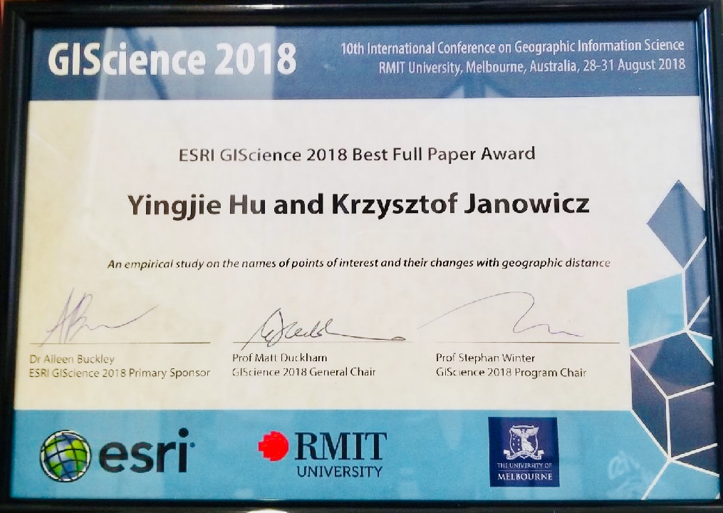
- Hu, Y.* & Janowicz, K. (2018): An empirical study on the names of points of interest and their changes with geographic distance, In: Proceedings of the 10th International Conference on Geographic Information Science (GIScience 2018), Aug. 29-31, Melbourne, Australia. [Best Paper Award]
- Ju, Y., Adams, B., Janowicz, K., Hu, Y., Yan, B., & McKenzie, G. (2016): Things and strings: improving place name disambiguation from short texts by combining entity co-occurrence with topic modeling, In: Proceedings of the 20th International Conference on Knowledge Engineering and Knowledge Management (EKAW 2016), Nov. 19-23, Bologna, Italy.
- Janowicz, K., Hu, Y., McKenzie, G., Gao, S., Regalia, B., Mai, G., Zhu, R., Adams, B., & Taylor, K. (2016): Moon landing or safari? a study of systematic errors and their causes in geographic Linked Data, In: Proceedings of the 9th International Conference on Geographic Information Science (GIScience 2016), Sep. 27-30, Montreal, Canada.
- Mai, G., Janowicz, K., Hu, Y., & McKenzie, G. (2016): A Linked Data Driven Visual Interface for the Multi-perspective Exploration of Data Across Repositories, In: Proceedings of 2nd International Workshop on Visualization and Interaction for Ontologies and Linked Data, Oct. 17, Kobe, Japan.
- Krisnadhi, A., Hu, Y., Janowicz, K., Hitzler, P., Arko, R., Carbotte, S., Chandler, C., Cheatham, M., Fils, D., Finin, T., Ji, P., Jones, M., Karima, N., Lehnert, K., Mickle, A., Narock, T., O'Brien, M., Raymond, L., Shepherd, A., Schildhauer, M., & Wiebe, P. (2015): The GeoLink modular oceanography ontology, In: Proceedings of the 14th International Semantic Web Conference, Oct. 11-15, 2015, Bethlehem, Pennsylvania, USA.
- Krisnadhi, A., Arko, R., Carbotte, S., Chandler, C., Cheatham, M., Hitzler, P., Hu, Y., Janowicz, K., Ji, P., Karima, N., Shepherd, A., & Wiebe, P. (2015): R2R+BCO-DMO - linked oceanographic datasets, In: Proceedings of Diversity++ Workshop at the 14th International Semantic Web Conference, Oct. 11-15, 2015, Bethlehem, Pennsylvania, USA.
- Hu, Y.*, Janowicz, K., Prasad, S., & Gao, S. (2015): Enabling semantic search and knowledge discovery for ArcGIS Online: a Linked-Data-driven approach, In Proceedings of 18th AGILE International Conference on Geographic Information Science, Jun. 9-12, Lisbon, Portugal .
- Hu, Y.*, Janowicz, K., & Prasad, S. (2014): Improving Wikipedia-based place name disambiguation in short texts using structured data from DBpedia, In Proceedings of 8th ACM SIGSPATIAL Workshop on Geographic Information Retrieval, Nov. 4, 2014, Dallas, TX, USA .
- Hu, Y.*, McKenzie, G., Yang, J., Gao, S., Abdalla, A., & Janowicz, K. (2014): A Linked-Data-driven Web portal for Learning analytics: data enrichment, interactive visualization, and knowledge discovery, in Proceedings of the Workshops at the Learning Analytics and Knowledge 2014 Conference, Mar. 24-28, 2014, Indianapolis, IN, USA. [2nd Prize Award]
- Gao, S., Hu, Y., Janowicz, K., McKenzie, G. (2013): A spatiotemporal scientometrics framework for exploring the citation impact of publications and scientists, In Proceedings of the 21th International Conference on Advances in Geographic Information Systems, Nov. 5-8, 2013, Orlando, FL, USA.
- Hu, Y.*, Janowicz, K., McKenzie, G., Sengupta, K., & Hitzler, P. (2013): A Linked-Data-driven and semantically-enabled journal portal for scientometrics, In Proceedings of the 12th International Semantic Web Conference, Oct. 21-25, 2013, Sydney, Australia, pp. 114-129.
- Hu, Y.*, Janowicz, K., Carral, D., Scheider, S., Kuhn, W., Berg-Cross, G., Hitzler, P., Dean, M., & Kolas, D. (2013): A geo-ontology design pattern for semantic trajectories, In Proceedings of the 2013 Conference On Spatial Information Theory, Sept. 2 - 6, 2013, Scarborough, North Yorkshire, UK.
- Lin, H., Hu, L., Hu, Y., Wu, J., & Yu, B. (2011): An integrated framework for retrieving and analyzing geographic information in Web pages, In Proceedings of the 19th International Conference on Geoinformatics, Jun. 24-26, 2011, Shanghai, China.
- Hu, Y.*, Wu, J., Zhong, H., Lv, Z., & Yu, B. (2010): An approach for integrating geospatial processing services into three-dimensional GIS, In Proceedings of the International Conference on Web Information Systems and Mining, Oct. 23-24, 2010, Sanya, Hainan, China, pp 154-161.
- Lv, Z., Hu, Y., Zhong, H., Wu, J., Li, B., Zhao, H. (2010): Parallel k-means clustering of remote sensing images based on MapReduce, In Proceedings of the International Conference on Web Information Systems and Mining, Oct. 23-24, 2010, Sanya, Hainan, China, pp 162-170.
- Zhong, H., Wu, J., Li, L., Lv, Z., Hu, Y., & Yu, B. (2010): Mobile and wireless GIS based upon independent development, In Proceedings of 2010 International Conference on Electrical and Control Engineering, Jun. 25-27, 2010, Wuhan, Hubei, China.
- Hu, Y.*, Wu, J., Lv, Z., Zhong, H., & Yu, B. (2010): A method for representing thematic data in three-dimensional GIS, In Proceedings of the 18th International Conference on Geoinformatics, Jun. 18-21, 2010, Beijing, China.
- Lv, Z.,Hu, Y., Zhong, H., Yu, B., Wu, J., Li, B., & Zhao, H (2010): Spatial indexing of global geographical data with HTM, In Proceedings of the 18th International Conference on Geoinformatics, Jun. 18-21, 2010, Beijing, China.
- Zhong, H., Li, P., Hu, Y., Lv, Z., Yin, J., Yu, B., & Wu, J. (2010): A solution for the data collection in the field survey based on mobile and wireless GIS, In Proceedings of the 18th International Conference on Geoinformatics, Jun. 18-21, 2010, Beijing, China.
- Yin, J., Xu, S., Wang, J., Zhong, H., Hu, Y., Yin, Z., Wang, K., & Zhang, X. (2010): Vulnerability assessment of combined impacts of sea level rise and coastal flooding for China's coastal region using remote sensing and GIS, In Proceedings of the 18th International Conference on Geoinformatics, Jun. 18-21, 2010, Beijing, China.
![[2nd Prize Award]](presentations/lakPrize.png)
Refereed Short Papers or Extended Abstracts
- Hu, Y.*, (2019): Starting with Data: Advancing Spatial Data Science by Building and Sharing High-quality Datasets, in Proceedings of the Spatial Data Science Symposium, Dec. 8-11, 2019, Santa Barbara, USA.
- Hu, Y.*, (2019): Building benchmarking frameworks for supporting replicability and reproducibility: spatial and textual analysis as an example, in Proceedings of the Workshop on Replicability and Reproducibility in Geospatial Research, Feb. 11-12, 2019, Tempe, USA.
- Hu, Y.*, (2018): EUPEG: Towards an Extensible and Unified Platform for Evaluating Geoparsers, in Proceedings of the 12th Workshop on Geographic Information Retrieval, Nov. 6-9, 2018, Seattle, USA.
- McKenzie, G. & Hu, Y. (2017): The “Nearby” exaggeration in real estate, in Proceedings of the Workshop on Cognitive Scales of Spatial Information, Sep. 4, 2017, L'Aquila, Italy.
- Hu, Y.*, Mao, H., & McKenzie, G. (2017): An NLP and geospatial workflow for harvesting local place names from geotagged social Web, in Proceedings of the International Symposium on Location-Based Social Media and Tracking Data, July 1-2, 2017, Washington DC, USA.
- Mai, G., Janowicz, K., Hu, Y., Gao, S. (2016): ADCN: an Anisotropic Density-based Clustering Algorithm, in Proceedings of the 24th International Conference on Advances in Geographic Information Systems (ACM SIGSPATIAL), Oct. 31-Nov 3, Burlingame, California, USA.
- Zhu, R., Janowicz, K., Yan, B., & Hu, Y. (2016): Which Kobani? A case study on the role of spatial statistics and semantics for coreference resolution across gazetteers, in: the Short Paper Proceedings of GIScience 2016, Sep. 26-30, Montreal, Canada.
- Hu, Y.* & Janowicz, K.(2016): Understanding the mapping sequence of online volunteers in disaster response, in: the Short Paper Proceedings of GIScience 2016, Sep. 26-30, Montreal, Canada.
- Yan, B., Janowicz, K., & Hu, Y. (2016): A data-driven approach for detecting and quantifying modeling biases in geo-ontologies using a discrepancy index, in: the Short Paper Proceedings of GIScience 2016, Sep. 26-30, Montreal, Canada.
- Hu, Y.* & Janowicz, K. (2015): Prioritizing road network connectivity information for disaster response, In: Proceedings of the ACM SIGSPATIAL International Workshop on the Use of GIS in Emergency Management, Nov. 3-6, Seattle, Washington, USA.
- Hu, Y.*, McKenzie, G., Janowicz, K., & Gao, S. (2015): Mining human-place interaction patterns from location-based social networks to enrich place categorization systems, in: Proceedings of the Workshop on Cognitive Engineering for Spatial Information Processes, Oct. 12, 2015, Santa Fe, New Mexico, USA.
- Hu, Y.*, Janowicz, K., Hitzler, P., & Sengupta, K. (2015): The Semantic Web Journal as Linked Data, In: Proceedings of 2015 International Semantic Web Conference (demos and posters track), Oct. 11-15, 2015, Bethlehem, Pennsylvania, USA.
- Janowicz, K., Krisnadhi, A., Hu, Y., Suh, S., Weidema, B., Rivela, B., Tivander, J., Meyer, D., Berg-Cross, G., Hitzler, P., Ingwersen, W., Kuczenski, B., Vardeman, C., Ju, Y., & Cheatham, M. (2015): A minimal ontology pattern for life cycle assessment data, In: Proceedings of the 6th Workshop on Ontology and Semantic Web Patterns at 2015 International Semantic Web Conference, Oct. 11-15, 2015, Bethlehem, Pennsylvania, USA.
- Yan, B., Hu, Y., Kuczenski, B., Janowicz, K., Ballatore, A., Krisnadhi, A., Ju, Y., Hitzler, P., Suh, S., & Ingwersen, W. (2015): An ontology for specifying spatiotemporal scopes in life cycle assessment, In: Proceedings of the Diversity++ Workshop at 2015 International Semantic Web Conference, Oct. 11-15, 2015, Bethlehem, Pennsylvania, USA.
- Gao, S., Yang, J., Yan, B., Hu, Y., Janowicz, K., & McKenzie, G. (2014): Detecting origin-destination mobility flows from geotagged Tweets in Greater Los Angeles Area, In Proceedings of the Eighth International Conference on Geographic Information Science, Sep. 24-26, 2014, Vienna, Austria.
- Gao, S., Yang, J., Janowicz, K., Hu, Y.,, Yan B., & McKenzie, G. (2014): TrajAnalyst: matching data to trajectory analysis modules via a conceptual framework, In Proceedings of Workshop on Analysis of Movement Data, Sep. 23, 2014, Vienna, Austria.
- Abdalla, A., Hu, Y., Carral, D., Li, N., & Janowicz, K. (2014): An ontology design pattern for activity reasoning, In Proceedings of 5th Workshop on Ontology and Semantic Web Patterns, Oct. 18, 2014, Riva del Garda, Trentino, Italy.
- McKenzie, G., Janowicz, K., Hu, Y., Sengupta, K., & Hitzler, P. (2013): Linked scientometrics: designing interactive scientometrics with Linked Data and Semantic Web reasoning, In Proceedings of the 12th International Semantic Web Conference, Oct. 21-25, 2013, Sydney, Australia.
- Hu, Y.* & Janowicz, K. (2012): Improving personal information management by integrating activities in the physical world with the semantic desktop, In Proceedings of the 20th International Conference on Advances in Geographic Information Systems, Nov. 6-9, 2012, Redondo Beach, California, USA, pp. 578-581.
- Hu, Y.*, Li, W., Janowicz, K., Deutsch, K., McKenzie, G., & Goulias, K. (2012): Using spatial-temporal signatures to infer human activities from personal trajectories on location-enabled mobile devices, In Proceedings of the Seventh International Conference on Geographic Information Science, Sep.19-21, 2012, Columbus, Ohio, USA.
- Deutsch, K., McKenzie, G., Janowicz, K., Li, W., Hu, Y., & Goulias, K. (2012): Examining the use of smartphones for travel behavior data collection, In Proceedings of the 13th International Conference on Travel Behavior Research, Jul. 15-20, 2012, Toronto, Canada.
Other Publications
- Nelson, T., Kedron, P., Goodchild, M.F., Fotheringham, S., Frazier, A., Li, W., Gao, S., Hu, Y., Tsou, M.H., Yuan, M., & Zhao B. (2020): Digital Contact Tracing and Surveillance: Geospatial opportunities, limitations, and research directions. ASU Spatial Analysis Research Center (SPARC) White Paper, pp 1-13.
Grants
(Total amount: ~ $1.5 million; my share: ~ $1.2 million)- PI, National Science Foundation (Award No.: 2416886), “Natural Disasters and Spatial Disparities in Community Resilience: Disrupted Human Mobility, Help Requests, and Voluntary Support.” , $400,000, 2024-2027.
- PI, Cornell University (Subaward; Primary: Novartis Foundation; Award No.: 231850), “Data-Driven Approach to Identify Determinants of Outcomes and Risk Factors of Cardiovascular Diseases in New York City Area.” $27,815, 2024-2025.
- Co-PI and UB PI, National Science Foundation (Award No.: 2401276), “ATD: Multiscale Anomaly Detection in Spatio-Temporal Multilayer Networks Encoding Human Mobility.” $250,000, 2023-2027.
- PI, National Science Foundation (REG Supplement Award; Main Award No.: 2117771), “Understanding Community Resilience in the 2021 Texas Winter Storm through Human Mobility Data and its Association with Locations Reported on Social Media.” $6,000, 2022-2023.
- PI, National Science Foundation (Award No.: 2117771), “Geospatial Artificial Intelligence Approaches for Understanding Location Descriptions in Natural Disasters and Their Spatial Biases.” $378,940, 2021-2026.
- Co-I and GeoAI Lead, National Aeronautics and Space Administration (Award No.: 80NSSC21K1183), “Near Real-time Forecasting and Change Detection for a Fire Prone Shrubland Ecosystem.” $483,239, 2021-2026.
- PI, Microsoft AI for Earth, “Near Real-time Forecasting and Change Detection for an Open Ecosystem by Integrating Artificial Intelligence and Ecological Modeling.” $15,000, 2020-2022.
- PI, American Association of Geographers, “Workshop on Integrating Machine Learning into Geographic Research.” $1,600, 2020-2021.
- PI, University of Tennessee, “How Can Local Housing Advertisements Help Disaster Response? A Geospatial Semantic Framework for Enriching Digital Gazetteers with Vernacular Place Names.” $3,334, 2017-2018.
- PI, University of California, Santa Barbara, “Measuring the Value of Geographic Information in a Mobile Environment.” $3,038, 2015-2016.
Invited Talks
- Invited Panelist, “Integrating Movement Data and AI Methods for Advancing Disaster Management”, Panel on Movement Analytics in the Era of Big Data, AI, and Open Science, March 18, 2026, San Francisco, California, USA.
- Invited Panelist, “Thoughts on GeoAI and GIScience”, Panel on Past, Present, and Future of GIScience, March 17, 2026, San Francisco, California, USA.
- Invited Talk, “Advancing Disaster Management by Integrating Geospatial Data and AI Methods”, Department of Civil, Structural, and Environmental Engineering, University at Buffalo, February 27th, 2026, Buffalo, NY, USA.
- Invited Panelist, “Innovations in addressing compound risks”, Workshop on compounding, cascading, and critical risks to U.S. infrastructure and security, August 4-6, 2025, Portland, Oregon, USA.
- Invited Panelist, “Understanding human-environment interactions for disaster management and sustainability solutions”, Spatial AI and Data Science Symposium at the AAG Annual Meeting, March 24, 2025, Detroit, Michigan, USA.
- Invited Talk, “Extracting location descriptions from disaster-related messages using geo-knowledge-guided LLMs”, NSF I-GUIDE Community Champion Program Virtual Consulting Office Series, March 11, 2025, Online.
- Invited Talk, “Generative AI, GIScience, and Disaster Management”, The 14th International Lectures of the International Society of Digital Earth (ISDE), January 21, 2025, Online.
- Invited Talk, “GeoAI: Integrating geospatial data and AI for studying human-environment interactions”, Department of Geography & Geographic Information Science, University of Illinois Urbana-Champaign, November 22, 2024, Champaign, Illinois, USA.
- Invited Panelist, “Promises and challenges of using large AI models in disaster response”, Specialist Meeting on Sociotechnical Foundations of GeoAI and Spatial Data Science, October 25-28, 2024, Vienna, Austria.
- Invited Plenary Talk, “GeoAI for Disaster Management,” U.S. Geological Survey (USGS) Annual Research Meeting, June 25, 2024, Lakewood, CO, USA.
- Invited Panelist, “GeoAI for Climate Science and Policy,” 2024 CaGIS + UCGIS Symposium, June 4, 2024, Columbus, Ohio, USA.
- Invited Talk, “GeoAI Solutions for Sustainable Development: The Handbook of Geospatial Artificial Intelligence,” United Nation ITU AI for Good Webinar, February 23, 2024, Online.
- Invited Talk, “Geo-knowledge-guided GPT model for extracting location descriptions from disaster-related messages,” The Federal Emergency Management Agency (FEMA), January 19, 2024, Online.
- Invited Talk, “Geo-knowledge-guided GPT model for extracting location descriptions from disaster-related messages,” City of Buffalo Emergency Services, December 28, 2023, Buffalo, New York, USA.
- Invited Panelist, “Human dynamics and GeoAI for enabling interdisciplinary research,” 2023 AAG Symposium on Human Dynamics Research: Status and Prospects, March 24, 2023, Denver, CO, USA.
- Invited Talk, “GeoAI: Integrating Geospatial Data and AI for Studying Human-Environment Interactions,” Department of Computer Science and Engineering, University at Buffalo, October 29, 2022, Buffalo, NY, USA.
- Invited Talk, “GeoAI: Integrating Geospatial Data and AI for Social Good,” Department of Geographical Sciences, University of Maryland College Park, April 21, 2022, Online.
- Invited Talk, “Exploring Geo-Text Data with Machine Learning Models for Knowledge Discovery,” UB Digital Scholarship Studio & Network, April 19th, 2022, Buffalo, NY, USA.
- Invited Talk, “GeoAI: Integrating Geospatial Data and AI for Social Good,” 2022 Northeast Regional Conference on Complex Systems, March 31, 2022, Buffalo, NY, USA.
- Invited Interview and Conversation (hosted by Dr. Matthew Dube), “The use of social media in emergency management,” University of Maine, February 24, 2022, Online.
- Invited Talk, “Aligning geographic entities from historical maps for building knowledge graphs,” the 19th International Conference on Spatial Data Handling and Geographic Intelligence, August 13, 2021, Online.
- Invited Talk, “Enhancing spatial data infrastructures with artificial intelligence,” 2021 World Geospatial Developers Conference, May 19, 2021, Online.
- Invited Talk, “A semantic and sentiment analysis on online neighborhood reviews,” POI Symposium at the Georgia Institute of Technology, April 30, 2021, Online.
- Invited Talk, “Advancing spatial and textual analysis with GeoAI,” Peking University, April 16, 2021, Online.
- Invited Talk, “Advancing spatial and textual analysis with GeoAI,” Spatial Tech Talk Series at the University of California Santa Barbara, October 21, 2020, Online.
- Invited Panelist, “Integrating Space and Place in GIScience: Examples, Challenges and Opportunities,” University Consortium for Geographic Information Science, June 10, 2019, Washington, D.C., USA.
- Invited Talk, “Progress and trends in geographic information systems and science,” the Singapore Program of the University at Buffalo, May 18, 2019, Singapore.
- Invited Panelist, “Understanding human-place interactions through volunteered geographic information,” AAG Panel on Volunteered Geographic Information, April 4, 2019, Washington, D.C., USA.
- Invited Talk, “Building benchmarking frameworks for supporting R&R: spatial and textual analysis as an example,” the Workshop on Replicability and Reproducibility (R&R) in Geospatial Research at Arizona State University, February 11-12, 2019, Tempe, AZ, USA.
- Invited Talk, “Exploring geo-text data: place names, place relations, and place sentiments,” University Consortium for Geographic Information Science, January 29, 2019, Online.
- Invited Talk, “Understanding place names, place relations, and place zones through geo-text data,” Oak Ridge National Laboratory, March 2, 2018, Oak Ridge, TN, USA.
Teaching
GEO 414/514: GIS and Machine Learning
GEO 414/514 is an introductory graduate course designed mostly for first-year graduate students but is also open to qualified senior undergraduates. It starts with basic Python packages such as SciPy and Pandas, moves on to processing vector and raster GIS data using GeoPandas and Rasterio, and then teaches students implementing machine learning models, such as random forest and DBSCAN clustering, for applications in land use and land cover classification and urban areas of interest detection.GEO 503: AI for Geospatial Applications
GEO 503 is an advanced GeoAI course and focuses on teaching various deep learning and AI models, e.g., fully connected neural networks, recurrent neural networks, and convolutional neural networks. I teach students the use of TensorFlow and PyTorch to implement these models, and the applications of these deep learning models to geospatial data (e.g., remote sensing images and GPS trajectory data) for problems like forecasting harmful algal blooms and predicting future human movement locations.GEO 281: Web-based Geographic Information Systems
GEO 281 is an entry-level GIS course for freshman and sophomore undergraduates. It introduces basic concepts about GIS and the Web, and uses a Web-based 3D GIS platform, Google Earth Pro, with vivid 3D virtual environments to engage students. This course aims to stimulate early interest in GIS and help students build a solid foundation for more advanced GIS courses.GEO 481/506: Geographic Information Systems
GEO 481/506 is an advanced GIS course for junior and senior undergraduates as well as first-year graduate students. It teaches more advanced topics, such as spatial analysis, GIS data structures, and global navigation satellite systems (GNSS), and uses a more sophisticated GIS tool, ArcGIS Pro, to help students learn these advanced topics.
Service
Leadership Roles
- Vice Chair, AAG Geographic Information Science and Systems (GISS) Specialty Group, 2025-2026.
- Lead Organizer, 2026 AAG Symposium on GeoAI and Deep Learning in Geospatial Research, Mar. 17-21, 2026, San Francisco, California, USA.
- Program Chair, Spatial Data Science Symposium, Dec. 5-6, 2025, virtual, 2025
- Academic Director and BOD Member, AAG Geographic Information Science and Systems (GISS) Specialty Group, 2024-2025.
- Lead Organizer, 2025 AAG Symposium on GeoAI and Deep Learning in Geospatial Research, Mar. 24-28, 2025, Detroit, Michigan, USA.
- Lead Organizer, 2024 AAG Symposium on GeoAI and Deep Learning in Geospatial Research, April 16-20, 2024, Honolulu, Hawaii, USA.
- Program Chair, 2023 Spatial Data Science Symposium, Sept. 5-6, 2023, virtual.
- Lead Organizer, 2023 AAG Symposium on GeoAI and Deep Learning in Geospatial Research, Mar. 23-27, 2023, Denver, USA.
- Co-Chair, 2021 ACM SIGSPATIAL Workshop on GeoAI: AI for Geographic Knowledge Discovery, Nov. 2, 2021, Beijing, China.
- Lead Organizer, 2020 AAG Symposium on GeoAI and Deep Learning in Geospatial Research, Apr. 6-10, 2020, Denver, USA.
- Co-Chair, 2019 ACM SIGSPATIAL Workshop on GeoAI: AI for Geographic Knowledge Discovery, Nov. 5, 2019, Chicago, USA.
- Lead Organizer, 2019 AAG Symposium on GeoAI and Deep Learning in Geospatial Research, Apr. 3-7, 2019, Washington DC, USA.
- Chair, 2018 ACM SIGSPATIAL Workshop on GeoAI: AI for Geographic Knowledge Discovery, Nov. 6, 2018, Seattle, USA.
- Paper Co-Chair, 9th Workshop on Ontology Design and Patterns, Oct. 9, 2018, Monterey, USA.
- Lead Organizer, 2018 AAG Symposium on GeoAI and Deep Learning in Geospatial Research, 2018, New Orleans, USA.
- Board of Director, Chinese Professional in Geographic Information Systems, 2018-2019.
- General Co-Chair, 2017 ACM SIGSPATIAL Workshop on GeoAI: AI for Geographic Knowledge Discovery, Nov. 7, 2017, Los Angeles, USA.
Journal Editorial Service
- Guest Editor, special issue: “GeoAI and spatial data science for fire research”, Computers, Environment and Urban Systems
- Editorial Board Member: International Journal of Geographical Information Science
- Editorial Board Member: Cartography and Geographic Information Science
- Editorial Board Member: Applied Spatial Analysis and Policy
- Guest Editor, special issue: “Methods, Models, and Resources for Geospatial Knowledge Graphs and GeoAI”, Transactions in GIS
- Guest Editor, special issue: “Geospatial artificial intelligence”, GeoInformatica
- Guest Editor, special issue: “Artificial intelligence techniques for geographic knowledge discovery”, International Journal of Geographical Information Science
Peer Reviewer for Journals
- Science Advances
- International Journal of Geographical Information Science
- International Journal of Disaster Risk Reduction
- International Journal of Disaster Risk Science
- Progress in Disaster Science
- Reliability Engineering & System Safety
- Journal of Environmental Management
- Annals of the American Association of Geographers
- Computers, Environment and Urban Systems
- Science of The Total Environment
- Transactions in GIS
- Cartography and Geographic Information Science
- Health & Place
- Social Science & Medicine
- Environment and Planning B: Urban Analytics and City Science
- Landscape and Urban Planning
- Cities
- International Journal of Digital Earth
- International Journal of Remote Sensing
- Journal of Spatial Information Science
- International Journal of Applied Earth Observation and Geoinformation
- Journal of Spatial Science
- Environmental Impact Assessment Review
- Computers and Electronics in Agriculture
- Professional Geographer
- Nature Scientific Reports
- BMC Public Health
- PLOS ONE
- Patterns- Cell Press
- IEEE Access Journal
- ACM Transactions on Intelligent Systems and Technology
- ACM Transactions on Spatial Algorithms and Systems
- Applied Energy
- Data & Knowledge Engineering
Program Committee Members
- Program Committee Member, 2026 International Conference on GeoAI, Ghent, Belgium, 3-6 June 2026.
- Program Committee Member, I-GUIDE Forum 2026: AI & Science: From Geospatial to Convergence, August 3-7, 2026, Chicago, Illinois, USA.
- Program Committee Member, 2026 International Conference on Spatial Information Theory (COSIT), September 22–25, 2026, York, UK.
- Program Committee Member, 2026 Cartography and Geographic Information Science Conference (CaGIS), September 8-11, 2026, St. Louis, USA.
- Program Committee Member, ACM SIGSPATIAL International Workshop on GeoAI: AI for Geographic Knowledge Discovery, November 3, 2025, Minneapolis, MN, USA.
- Program Committee Member, 2025 International Conference on Geographic Information Science (GIScience), August 26-29, 2025, Christchurch, New Zealand.
- Program Committee Member, ACM SIGSPATIAL International Workshop on GeoAI: AI for Geographic Knowledge Discovery, Oct. 29, 2024, Atlanta, Georgia, USA.
- Program Committee Member, I-GUIDE Forum 2024: Convergence Science and Geospatial AI for Environmental Sustainability, Oct. 14-16, 2024, Jackson, Wyoming, USA.
- Program Committee Member, 2024 CaGIS + UCGIS Symposium, June 3-6, 2024, Columbus, Ohio, USA.
- Program Committee Member, 2024 International Conference on Spatial Information Theory (COSIT), September 17-20, 2024, Québec City, Canada.
- Program Committee Member, Geographic Information Extraction from Texts (GeoExT), March 24-28, 2024, Glasgow, Scotland.
- Program Committee Member, ACM SIGSPATIAL International Workshop on GeoAI: AI for Geographic Knowledge Discovery, Nov. 13-16, 2023, Hamburg, Germany.
- Program Committee Member, 12th International Conference on Geographic Information Science, Sep. 13-15, 2023, Leeds, UK.
- Program Committee Member, 2022 International Conference on Spatial Information Theory (COSIT), Sep. 5-9, 2022, Kobe, Japan.
- Research Committee Member, UCGIS Research Committee, 2019-2022.
- Program Committee Member, AAG 2022 Symposium on Data-Intensive Geospatial Understanding in the Era of AI and CyberGIS, Feb. 25- Mar. 1, 2022, Online.
- Program Committee Member, KDD 2021 workshop on Data-driven Humanitarian Mapping, Aug. 14, 2021, Online.
- Program Committee Member, 2021 ACM SIGSPATIAL Conference, Nov. 2-5, 2021, Beijing, China.
- Program Committee Member, 2021 ACM SIGSPATIAL Geospatial Humanities Workshop, Nov. 2, 2021, Beijing, China.
- Senior Program Committee Member, 2021 International Conference on Geographic Information Science, Sept. 15-18, 2021, Poznań, Poland.
- Program Committee Member, 2020 ACM SIGSPATIAL Conference, Nov. 3-6, 2020, Seattle, USA.
- Senior Program Committee Member, 2020 International Semantic Web Conference, Nov. 2-6, 2020, Athens, Greece.
- Program Committee Member, 2020 ACM SIGSPATIAL Geospatial Humanities Workshop, Nov. 3, 2020, Seattle, USA.
- Program Committee Member, 2019 ACM SIGSPATIAL Conference, Nov. 5-8, 2019, Chicago, USA.
- Program Committee Member, 2019 International Conference on Spatial Information Theory (COSIT), Sept. 9-13, 2019, Regensburg, Germany.
- Member, AAG Geographic Information Science and Systems (GISS) Specialty Group, 2016-2018.
- Program Committee Member, Location Privacy and Security Workshop, 2018.
- Program Committee Member, 27th International World Wide Web Conference, Apr. 23-27, 2018, Lyon, France.
- Program Committee Member, 9th International Conference on Knowledge Capture, Dec. 4th-6, 2017, Austin, USA.
- Organization Committee Member, Workshop on Geo-Knowledge Graphs, Sep. 4, 2017, L’Aquila, Italy.
- Program Committee Member, 16th International Semantic Web Conference, Oct. 21-25, 2017, Vienna, Austria.
- Program Committee Member, 8th Workshop on Ontology Design and Patterns, Oct. 21, 2017, Vienna, Austria.
- Program Committee Member, 7th Workshop on Ontology and Semantic Web Patterns, Oct. 17, 2016, Kobe, Japan.
- Program Committee Member, 6th Workshop on Ontology and Semantic Web Patterns, Oct. 11, 2015, Bethlehem, USA.
- Program Committee Member, 29th AAAI Conference on Artificial Intelligence, Jan. 25-30, 2015, Austin, USA.
- Program Committee Member, 19th Conference on Knowledge Engineering and Knowledge Management, Nov. 24-28, 2014, Linköping, Sweden.
Media Coverage
- UB Now: As wildfires intensify, UB researchers test if AI can improve fire spread prediction
- Encyclopedia Britannica Kids: Ask the experts, Yingjie Hu: An introduction to geospatial technologies and AI
- American Association of Colleges and Universities: Yingjie Hu, University at Buffalo – Can ChatGPT Help First Responders During Disasters
- Channel 2 WGRZ: Study looks at social media's role in connecting the community during the 2022 blizzard
- Buffalo News: Facebook groups saved lives during '22 blizzard. UB studying how they kept communities connected
- NPR Academic Minute: Yingjie Hu, University at Buffalo – Can ChatGPT Help First Responders During Disasters (story on February 22, 2024)
- Emergency Management Magazine: How ChatGPT Could Help First Responders During a Disaster
- Homeland Security News Wire: ChatGPT Could Help First Responders During Natural Disasters
- Science Daily: How ChatGPT could help first responders during natural disasters
- NewsBreezer: ChatGPT improves emergency management by identifying emergency locations via social media data
- Digital Information World: ChatGPT Enhances Emergency Management by Identifying Distress Locations via Social Media Data
- Forbes: Welcome To The Vice Age: How Sex, Drugs And Gambling Help Americans Cope With Covid
- CNN: We really did buy more alcohol during the early pandemic, study finds
- NPR-WBFO: UB study of 16 states confirms, yup, we drank a lot more last year
- Miami Herald: Americans stocked up on alcohol early during COVID, study finds. What did they buy?
- LMTOnline: Study shows COVID-19 impact on booze habits, TX bought more beer
- Thrillist: Americans Did Indeed Buy More Alcohol During the Pandemic
- New Medical: UB researchers analyze pandemic-related shifts in alcohol sales across 16 U.S. states
- UB Now: Two UB faculty receive NSF funding to study social media in disaster response
- UB Now: Field biologists, NASA planes to map biodiversity in South Africa
- UB Now: Researcher explains benefits of using geotagged content in research
- Phys.org: How online neighborhood reviews could aid urban planning
- Smart Cities Dive: A new source of planning data: online reviews
- Planetizen: Study Examines the Benefits of Online Reviews to Planning Research
- IEEE GlobalSpec: Online reviews can help in future urban planning
- GIS Lounge: GIS and Named Entity Recognition: Identifying Geographic Locations in Text
- Reuters: Crowd-sourced maps for natural disasters boosted by new algorithm
- EurekAlert!: UT professor develops algorithm to improve online mapping of disaster areas
- Voice of America (VOA News): New Algorithm Boosts Crowd-sourced Maps for Natural Disasters
- Communications of the ACM: Professor Develops Algorithm to Improve Online Mapping of Disaster Areas
- Phys.org: Team develops algorithm to improve online mapping of disaster areas
- GIS and Science: Metadata Topic Harmonization and Semantic Search for Linked-Data-Driven Geoportals: A Case Study Using ArcGIS Online
Contact
Yingjie (Jason) Hu
Email: yhu42@buffalo.eduFollow me on:

See also:


