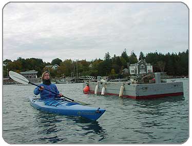
Launching from Southwest Harbor on a cold October morning (withOUT a pfd)
PHOTOS
1
2
3
4
5
6
7
8
9
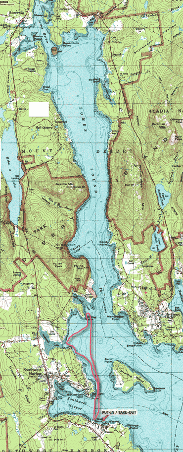
ROUTE MAP
Click on Map to Enlarge
 |
Description:
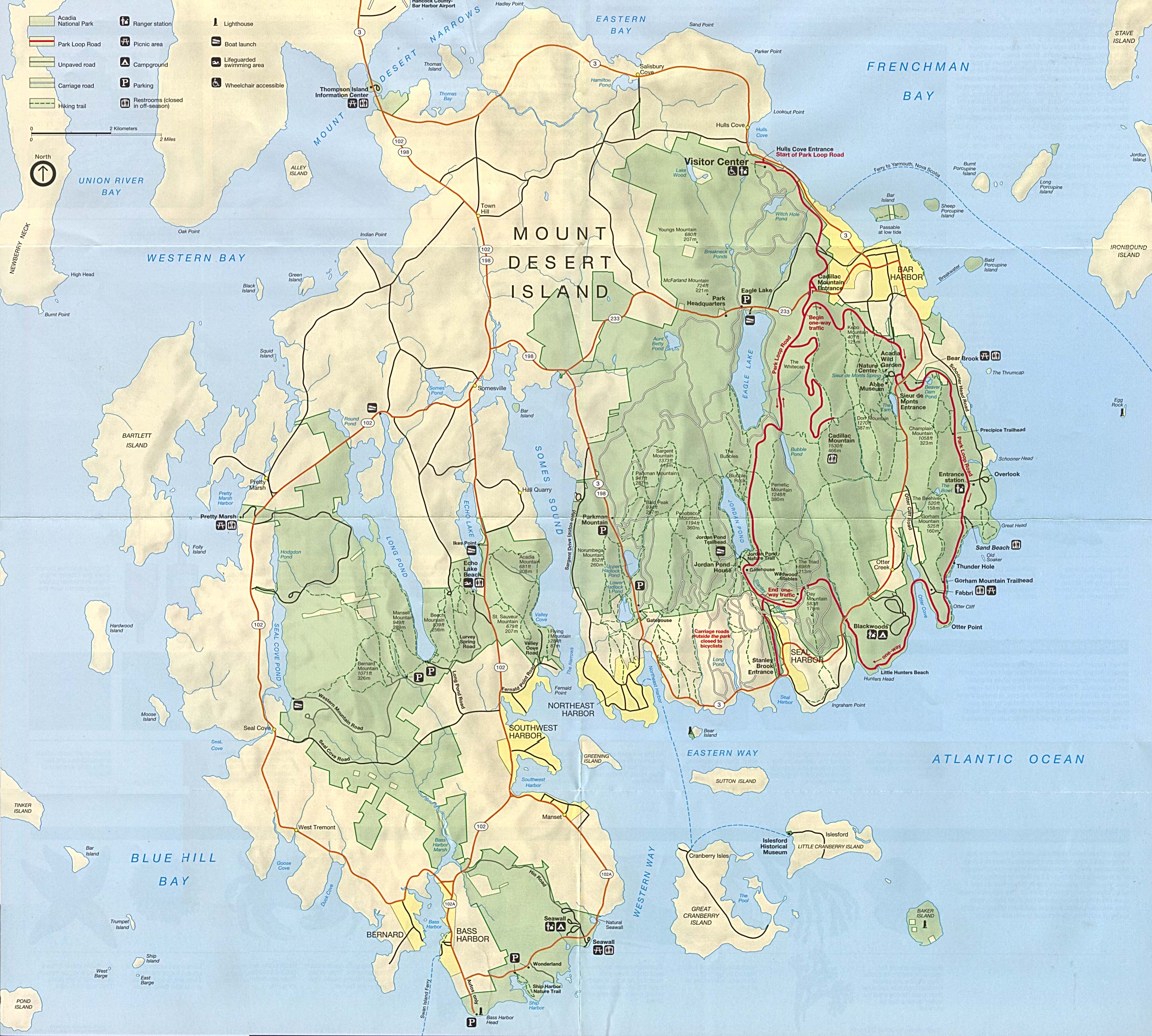
Somes Sound is the only fiord on the East Coast of the United States. Fiords are deep fingers of sea water surrounded by tall cliffs or mountains. The mountains enclosing Somes Sound (To the East- Sargent Mtn, Penobscot Mtn; To the West- Flying Mtn, St Saveur Mtn, and Acadia Mtn) rise 850 feet above water, which attains depths of 150 feet. Though Somes Sound is deep over much of it's length, there is a small band of shallow depth, caused from a glacier deposit of debris, called a terminal mouraine, which is referred to as "The Narrows". The water here at the mouth of the sound is only 10 feet deep. Since it is narrower and shallower at the mouth, water has a harder time leaving during tides. This creates an environment to support a wide variety of wildlife including lobsters, loons, seals, great blue herons, and bald eagles. Unfortunately, we encountered none of these, only gulls. But the landscapes were beautiful, and most of all, we were SEA kayaking for the first time!
The boat launch in Southwest Harbor is busy, even in late October, and services the local fishing boats and other maritime industries here. It was really fun to be in a spot like this. Paddling on the ocean was a really wonderful experience and one I'd like to do again sometime. The salt air and the conditions of the tides made for a really neat paddle. We were on the ocean!!!
Regrettably, we did not make it to the narrows, since the winds and waves coming off the ocean proved to be more than we could handle. We returned to the harbor exhausted, though we vowed to return someday.
There is another launch for kayaks on the Eastern side of the Sound, and we did find the sign for it on Sargent Drive, but did not investigate. On the Western side of Somes Sound, you might also try launching from Hall Quarry. There is no official boat launch site at Hall's Quarry, though if you ask at the small boat yard at water's edge they may grant you permission to launch there. A smile and friendly manner will help, I'm told, as it will with anything else you need on Mt Desert Island.
We stayed in the cutest little cottage in Salisbury Cove, away from the crowds and hustle and bustle of Bar Harbor. Mary was very hospitable and made our stay very enjoyable. Thank you again, Mary for the extra day...I hope your pipes were okay.
We did venture into town a couple of times but tried our best to frequent local spots and avoid as much tourism as possible.
Put In:
Southwest Harbor
Directions: Just south of downtown Southwest Harbor, turn left off Maine Route 102 onto 102A. After 1 mile, turn left onto Mansell Lane. At the end of thee road, turn left onto Shore Road. The boat ramp is a short distance on the right.
Take out:
Southwest Harbor
Facilities:
There's a porta-john at the launch, and a small local restaurant stand as well, though it was closed when we were there (probably seasonal). There are a number of places in Southwest Harbor, a mile away.
Distance:
Portages: None
Loop Trip: No
Camping: Yes. There are camp sites available in Acadia National Park, reservations suggested.
LINKS:
Cottages at Salisbury Cove- a great place to stay when it's too chilly for camping
Acadia Magic - Salisbury Cove Info
Acadia National Park - National Park Service site
Tide Chart for Mount Desert Island
Southwest Harbor - General Info
Map of Mount Desert Island - big jpg!
|