[Up]
Example Cognitive Maps
Duncan, Susana, Mental Maps of New York. New York, Dec. 19, 1977; research conducted by Stanley Milgram.
1. Feature Maps
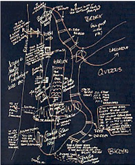 |
This map has a lot of written description in addition to key
landmarks. Notice that this individual included much more than just Manhattan - New
Jersey and all the boroughs. The rivers, tunnels and bridges are prominent as
is Central Park. Midtown is labeled very large and the distinctive form of the G.W.
Bridge is rendered. A few streets are shown. Drawn by John, a 29 year old resident of the Upper West Side who is a writer. |
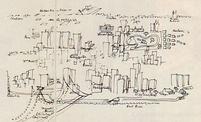 |
This map includes both two and three dimensional
images. The focus is on the the east side and the area surrounding Central Park. Not
much else is shown. Locations of features are very inaccurate beyond the park and
East Side. Drawn by Madeline, a public relations executive who lives on the Upper East Side. |
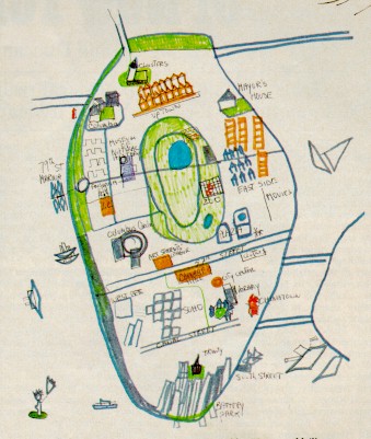 |
This map is focused on the island of Manhattan and is color
coded. Some of the bridges are included but not all and no tunnels. Only the
edge of Brooklyn is shown and the rivers look like the ocean. Boats figure
prominently. Several key streets are shown but mostly crosstown.
Drawn by Susan, 35 year old painter who lived on the Upper West Side. |
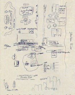 |
This is a very localized map showing a limited area of Harlem with
some major landmarks like the Statue of Liberty and Central Park located in their relative
position. A detailed rendering of an intersection and streetscape is included. Only
the Harlem River is shown. Co-op apartment buildings along FDR Drive are also
included.
Drawn by Cynthia, 40+ teacher who lives in Harlem. |
 |
Very accurate and complete map of Manhattan below the north
boundary of Central Park including streets, landmarks, rivers, bridges tunnels. The
edges of Queens and Brooklyn are included. Drawn in color and with some three
dimensional elements.
Drawn by Mary, a 21 year old free lance designer who lives in Brooklyn Heights. |
2. Evaluation Map
 |
This map is a compilation of results of a question
asking about the places in new York that residents fear the most. Key:
|
3. Another type of Evaluation Data
Milgram asked his respondents to name secret beauty spots in the City. These are some of the ones they reported.
 |
Sniffen Court in Mid Manhattan |
 |
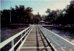
Crocheron Park in Queens |
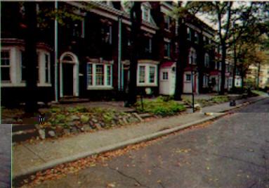 |
Albemarle Terrace in Brooklyn |
 |
Douglas Manor in Queens |
Go to Top or Return to Cognitive Mapping Analysis