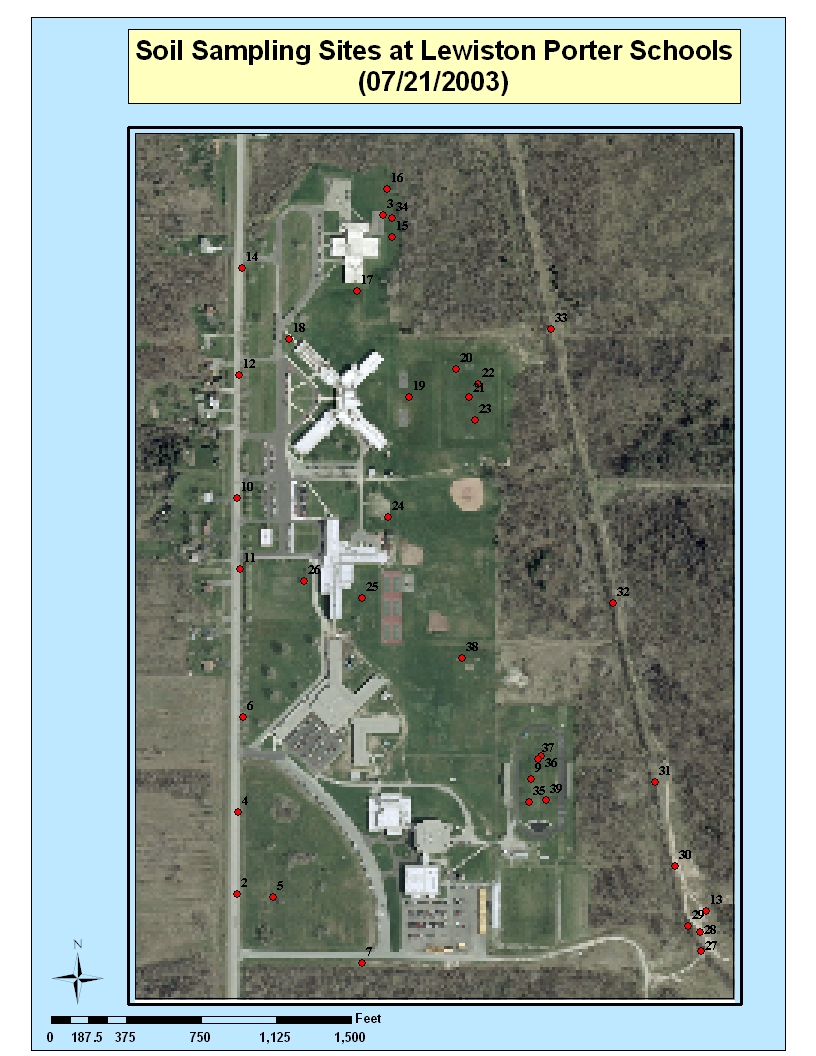
NEW NEW
NEW lewportsampling.pdf sites also shown below
in jpg format
NEW NEW
NEW lewportsampling.pdf sites also shown below
in jpg formatBelow are three maps for use for planning the soil sampling, in picture (jpg) file format.
We also provide downloadable Maps in PDF (portable document file) Format
For a free reader for PDF files, go to www.adobe.com
List of Files for download:
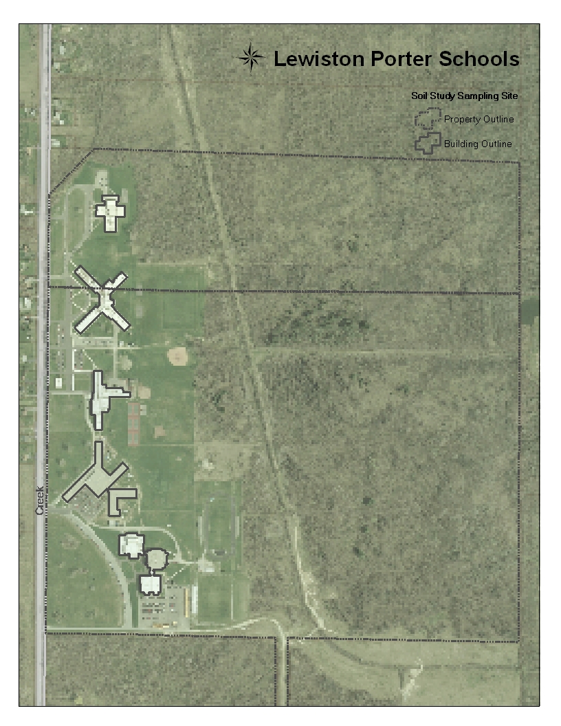
Aerial Map of Campus lewportschool1.pdf Also shown below in jpg format.
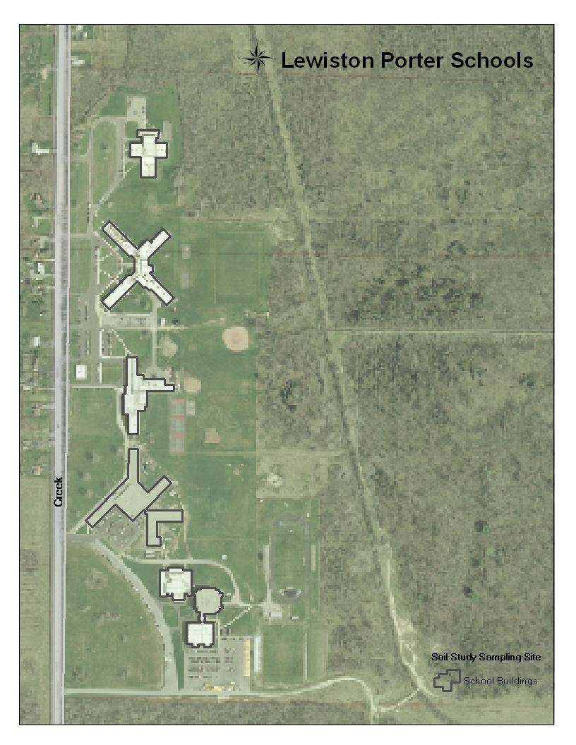
Aerial Map Close up of Schools lewportschool2.pdf Also shown below in jpg format
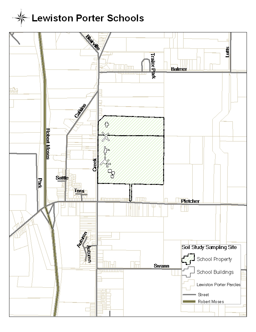
Property line map of Lewiston Porter Region, Pletcher, Creek and Balmer Roads
lewportarea.pdf also shown below in jpg format
NEW NEW
NEW lewportsampling.pdf sites also shown below
in jpg format
Information Added October 27, 2003!
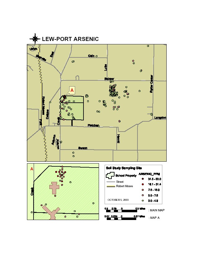
Results of Arsenic mapping over LewPort Campus and LOOW site lewportARSENIC.pdf
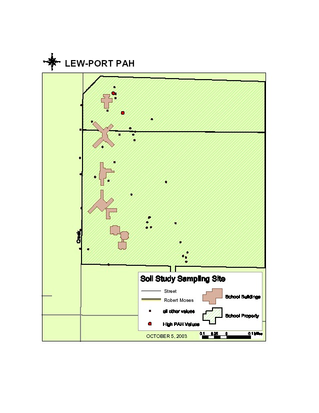
Results of Polyaromatic Hydrocarbon Results from Campus: lewportPAH.pdf
Both shown below as jpg files