
Collaborative Research:
Improving Small Area Population Estimation with High-Resolution Remote
Sensing
National Science
Foundation Award # 0822489 August
1, 2008 - January 31, 2012 |
|
|
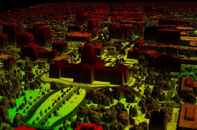
3-D visualization of LiDAR altimetry data |
Principal
Investigator:
Le Wang Department of Geography Co-Principal
Investigator:
Peter Rogerson Department of Geography Collaborative
Investigators:
Changshan Wu Department of Geography University of Wisconsin-Milwaukee Frederick Day Department of Geography Texas State University-San Marcos |
Summary
Small-area
population estimates are essential for understanding and responding to many
social, political, economic, and environmental problems. Population estimates
are critical in decisions concerning resource allocation, market area
delineation, new facility/transportation development, as well as generating
diagnostic indicators for environmental and socioeconomic assessments.
Despite its significance and the update frequency needed, detailed and
accurate population and socioeconomic information is only available for one
date per decade through the national census. The recent advancements in
remote sensing technology coalesced with existing knowledge in the field of
applied demography can lead to developing an effective method to project
population more accurately in different applications. For example, the launch
of IKONOS in 1999 provided new opportunities to investigate urban physical configurations
at a fine spatial scale from very high resolution (VHR) optical images.
Likewise, the advent of Airborne Light detection and Ranging (LiDAR) sensors
for measuring the vertical information has complemented the information
provided by optical VHR imagery in many urban studies. The overall objective
of this project is to develop detailed (census block level) and accurate
population estimates through integrating the traditional housing unit methods
and remote sensing technologies. |
|
Call
for Papers
|
|
Previous Publications on this Research Topic
- Wu, S., L. Wang, and X. Qiu, 2008. Incorporating GIS building data and census housing statistics for sub-block-level population estimation, Professional Geographers, 60(1):121--135.
- Silván-Cárdenas, J.L., and L. Wang, 2008. The sub-pixel confusion-uncertainty matrix for assessing soft classifications, Remote Sensing of Environment, 112(3), 1081--1095.
- Wu, S., J.L. Silván-Cárdenas, and Wang, L., 2007. Per-field urban land use classification based on tax parcel boundaries, International Journal of Remote Sensing, 28 (12) 2777--2801.
- Tang, J.M., L. Wang, and S. Myint, 2007. Improving urban classification through fuzzy supervised classification and spectral mixture analysis, International Journal of Remote Sensing, 28(18):4047--4063.
- J.L. Silván-Cárdenas and L. Wang, 2006. A Multi-resolution Approach for Filtering LiDAR Altimetry Data, ISPRS Journal of Photogrammetry and Remote Sensing, 61(1): 11--22.
- Wu, S., X. Qiu and L. Wang, 2006. Using Semi-variance Image Texture Statistics to Model Population Densities, Cartography and Geographic Information Science, 33(2): 127--140.
- Wu, S., B. Xu, amd L. Wang. 2006. Urban land use classification using variogram-based analysis with an aerial photograph, Photogrammetric Engineering and Remote Sensing, 72(7):813--822.
- Wu, S., X. Qiu, and L. Wang. 2005. Population estimation methods in GIS and remote sensing: a review, GIScience and Remote Sensing, 42:58--74.