GEO485/551 "Cartographic and Geographic Visualization" (Spring 2008)
Course: |
GEO485/551 Cartography and Geographic Visualization |
Name: |
Kevin Schellinger |
Term: |
Spring 2008 |
e-mail: |
Kjs35@buffalo.edu |
1. Maps of Earthquake Locations in Mexico
The following two thumbnail images show the location of earthquakes in Mexico. Click on each image to see a larger map.
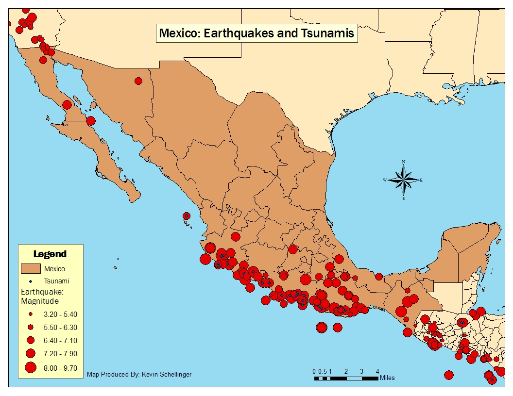
Map 1. The location and magnitude of earthquakes in Mexico. Each red circle is a earthquake and the size represents the magnitude. Each blue dot indicates that the occurence of a tsunami.
|
|
Map 2.
The location and magnitude of earthquakes and related deaths in
Mexico.
|
©2008 (Kevin Schellinger), University at Buffalo
(Last updated: April 24, 2008 EST)